
Walk a Panama City Street
A good street-by-street search keeps ownership, occupancy, and geography separate. Begin with one known address, not a person guessed from a commercial listing. The Bay County Property Appraiser supplies the assessed parcel record. BayView shows that parcel beside the rest of the road and identifies its municipal setting. The Bay County Clerk then connects the owner name and legal description to recorded instruments. Public voter data and reverse directories can add resident evidence, but neither is a complete household list.
- Enter the site address in the Bay County Property Appraiser route and save the parcel ID, assessed owner, situs address, mailing address, and legal description.
- Open BayView, search the address or road, zoom to parcel polygons, and click lots in sequence.
- Use the owner and legal terms in the Clerk recording search. Read the instrument before deciding what role each party held.
- For public voter rows by residence street, use a lawful state extract request. The self-lookup checks one voter and cannot browse a block.
- For an earlier occupant, consult reverse directories by address and compare the closest earlier and later editions.
The chain works because the parcel ID and legal description are steadier than a street string. A road label, house number, or municipal heading can change. Preserve book/page or instrument numbers as you move from the map to the deed record.
Panama City Parcel Search Keys
The assessor route supports owner, site or property address, and parcel ID searches. Live qPublic labels were partly blocked during research, so wildcard behavior should not be assumed. BayView offers a verified prompt for parcels, addresses, or roads. Its result cards show the fields below, and DETAILS hands the search to the Property Appraiser record.
| Search key or field | Use in a street lookup | Important limit |
|---|---|---|
| Parcel ID | Joins map, assessment, tax, and deed notes | Treat the hyphenated code as an exact key |
| Owner | Names the assessed owner | Confirm legal title in the recorded deed |
| Address | Locates the site on the map | Not the owner mailing destination |
| Acres / Current Use | Distinguishes nearby parcels | Does not describe a household |
| Road search | Positions the map along a named street | Click parcels individually for details |
A situs address is the assessed physical location. A mailing address is where the tax notice goes. If those differ, the record may indicate an owner who receives mail elsewhere, but it does not prove who sleeps at either place. Homestead status can support owner-occupancy for a qualifying period without naming all occupants.
Browse Panama City in BayView
BayView is the practical map half of a Panama City street directory search. Search the road, select a Parcels result, zoom until lot outlines appear, and click each adjoining shape. Context layers can show the municipal boundary, commissioner district, flood zone, future land use, service area, and soil. These layers explain where a parcel sits; they do not identify a resident.
The viewer also provides Measure, Draw, Print, and Extract Data tools. An export can assemble selected parcel features, while the parcel service caps a request at 2,000 features. Map geometry remains informational. Easements, rights of way, condominiums, and shared drives can make screen adjacency look simpler than the legal boundary.
The Bay County Map Gallery shows the county's public mapping choices before a reader opens the parcel viewer.
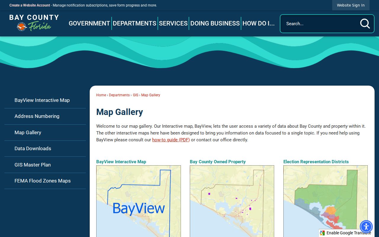
The gallery confirms that election, flood, evacuation, school-zone, and land-use maps are separate context products. Use the parcel viewer for the address chain.
Note: BayView's surrounding-area tool counts nearby amenities at set radii; it is not a list of owners or residents.
Panama City Street Record Sources
No single public roll is a complete street directory. The best result comes from comparing records made for distinct official tasks. The table keeps each keeper, useful fact, and access limit in view.
| Address source | Official keeper | Street evidence | Access route |
|---|---|---|---|
| Assessment roll | Bay Property Appraiser | Owner, mail and situs addresses, legal, exemptions, sales | Free web search; office at 860 W 11th Street |
| Parcel map | Bay County GIS | Parcel geometry, road, use, jurisdiction, map layers | Free BayView; GIS office and data requests |
| Recorded deeds | Bay County Clerk | Parties, legal description, recording citation | Online images; phone, email, mail, or counter copies |
| Voter information | Florida Division of Elections | Public registration fields by residence address | One-person self-lookup or formal physical-disk extract |
| Permits and code cases | Panama City | Applicants, agents, work, address, hearing evidence | Online material plus email, phone, or in-person request |
| Reverse directories | Library and cited archives | Listed occupant or business at an older address | Local History Room, digital volumes, or source-specific access |
When the web portal fails, the channel matters. The Clerk's Official Records Division accepts certified-copy requests at 850-747-5100 or recording@baycoclerk.com, as well as mail or counter requests at 300 E 4th Street. Property Appraiser staff can be reached at 850-248-8401. Panama City records may be requested at publicrecords@panamacity.gov, by telephone at 850-872-7225, or in person.
Deeds Behind Panama City Addresses
A deed index is organized by parties and legal land, not as a native street directory. Start from the current parcel card, copy the legal description, and find the latest deed. Note each party's role, the record date, document type, book type, book/page, and Clerk instrument number. Then search the seller as a possible buyer in an earlier instrument for the same lot, block, subdivision, or metes-and-bounds description.
The modern index covers records after January 1, 1987. Earlier work moves to the Clerk's free Direct and Reverse index books. Bands include EPR through 1912, 1913–1938, 1939–1959, 1960–1977, 1978 through May 1982, June through December 1982, and separate books for 1983 through 1986. Search individuals and firms, read the name sheet for the deed citation, and verify the party role on the image.
- Parcel
- A mapped unit of land tracked by an assessor ID.
- Situs address
- The physical address assigned to the assessed property, distinct from owner mail.
- Plat
- A recorded drawing that identifies lots, blocks, streets, and easements.
- Criss-cross directory
- A directory arranged by street and house number rather than only by surname.
Note: The 1987 line marks an access change between interfaces, not proof that Bay County began keeping land records that year.
Panama City Permits by Address
Municipal files can add names tied to work at an address. Panama City Building Services handles tax districts 16 and 31. Its files may name an owner, authorized agent, applicant, contractor, job type, and inspection history. Permits cover construction, repair, demolition, occupancy changes, roofing, sheds, decks, irrigation, and regulated trade work. Those names describe a role in the project, not a complete resident list.
First verify city jurisdiction through qPublic's Tax Area and BayView's Municipal Boundary. Then consult Panama City permits or ask Building Services at building@panamacity.gov and 850-872-3025. For code matters, published hearings may provide a case and property address. When no public browse screen answers the question, Code Compliance and the City Clerk's request channels are the documented fallback.
Panama City Voters by Street
Florida's registration-status tool is built to check one voter using identifying details. It cannot browse a Panama City road. A street-level voter view instead requires the Division of Elections full extract, which contains active and inactive records from the prior-month snapshot and may be sorted by residence address after lawful receipt.
The state delivers that extract on a physical disk by mail or pickup, not by email or online download. A request includes contact and mailing details and goes to Elections Records in Tallahassee. Protected-person exceptions remain excluded, and preregistrant information for ages 16 and 17 is confidential. Public registration fields do not reveal ballot choices.
Street-search tip. A voter row can support that a registered person used an address, but it neither lists every occupant nor proves current presence.
Older Panama City Streets
The Bay County Public Library Local History Room reports city directories from 1935 to the present, though that collection statement does not promise every annual volume. Official city environmental research also documents address-to-occupant use of selected Polk editions from 1953 through 1985 and later reverse listings for selected years from 1992 through 2017. The full historical shelf belongs to the Panama City city directory collection; here, the key point is that a reverse section can place a listed person or business at a street address for one edition.
Before 1926, search Panama City, St. Andrews, and Millville as separate headings. Their consolidation can make a name appear to move when only the municipal label changed. Newspapers, census schedules, plats, and legal descriptions help bridge a missing edition or altered street string.
Limits of Panama City Street Records
A tax owner is not a roster of residents. Deed parties are not everyone who occupied the site. A permit applicant may be an agent, and a directory lists only people or firms captured by that publication. Utility customer data was not verified as a public source, while motor-vehicle address data is restricted. Protected property and voter addresses may also be withheld.
Use the Panama City street directory chain for family research, parcel history, civic curiosity, or checking a seller's link to land. Record the source date and official citation. If a name is absent, state only that the consulted record did not show it.
Lawful use. Public address records may be used only for lawful purposes. Never use them to stalk, harass, intimidate, or harm a person, and never try to reconstruct a protected address.