
Panama City Previous Resident Eras
Each source answers a different part of the previous-residents question. The current parcel record gives the legal description and a starting owner. Recorded deeds identify title parties. Directories and census schedules can name occupants who never held title, while maps show the physical place without naming its household. Coverage overlaps, so dates and roles should be recorded with every find.
| Source | Years It Covers | Where Held | What It Shows |
|---|---|---|---|
| Clerk Official Records | 1987 to present | Bay County Clerk online | Parties, document type, book/page, instrument and image |
| Direct/Indirect books | EPR through 1986 | Clerk DirectApp scans | Name index leading to deed book and page |
| City directories | Collection stated as 1935 to present | Bay County Public Library | Listed residents and businesses by edition |
| Polk reverse editions | Selected editions, 1953 to 1985 | Local History Room | Address-to-occupant entries |
| Federal census | Public schedules through 1950 | NARA and library resources | Household members at a ten-year snapshot |
| Sanborn maps | 1917 and 1927 | Library of Congress | Building form, use, materials, streets and numbers |
For a recent transfer, begin with the assessor and the modern Clerk search. For an older property, carry the last verified party into the scanned name books. To identify who actually lived there, match the deed dates against the closest directory and census years. The library can also help locate newspapers, maps, yearbooks, and vertical files when an edition is missing.
Start Panama City Resident History
The Bay County Property Appraiser is the sound first stop. Record the parcel ID, assessed owner, situs address, owner mailing address, legal description, exemptions, and sale references. A situs address locates the assessed site. A mailing address routes tax notices. Neither proves who formed the full household.
Keep the parcel ID and legal description in the research notes. They join map, assessment, tax, and deed records more reliably than a street string. A homestead exemption is consistent with owner occupancy during the qualifying period, but it does not identify all previous residents or prove that the owner is present now.
For the current street-by-street route, use the Panama City street directory. The task here remains chronological: lock one parcel, then move backward.
Search Panama City Deed Records
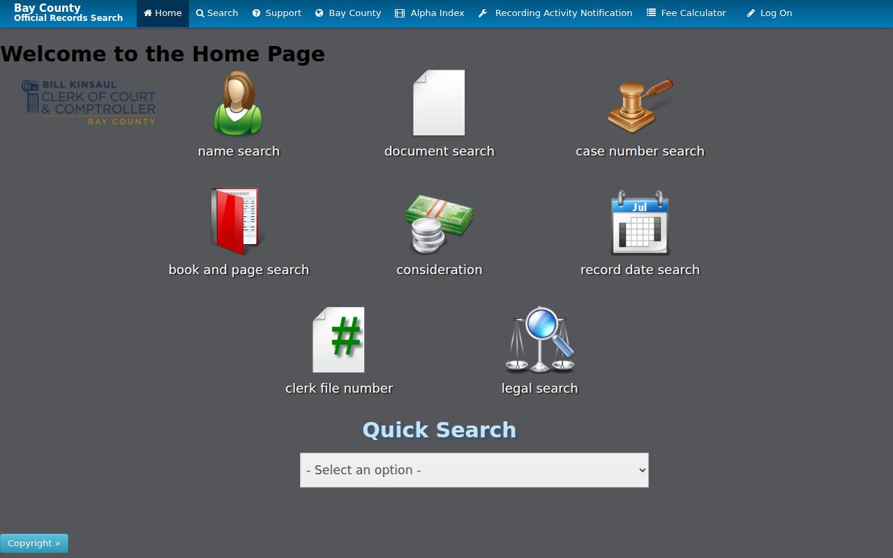
The modern Bay Clerk recording search accepts name, document, case number, book/page, consideration, recorded-date, Clerk file number, and legal searches. Results can show parties, recorded date, document type, book type, book/page, and instrument number. Preserve those citations before opening an image. A recorded date may be later than the date the parties signed.
The modern search is also one of the successful captures assigned to this address-history page. The screenshot below is linked to the Clerk's live source so its interface can be checked before a search.
The free web image is an uncertified research copy. For a certified deed, supply the instrument number or book/page to the Official Records Division at 850-747-5100 or recording@baycoclerk.com. Copies cost $1 per page plus $2 for certification according to the Clerk's published schedule.
Trace Panama City Resident Title
A chain of title is the sequence of recorded transfers for the same property. Begin with a known deed, then identify the seller and search for the earlier deed by which that seller acquired the same legal parcel. Do not assume a name hit played a buyer or seller role. Estates, companies, lenders, and witnesses may also appear.
- Copy the current parcel ID and legal description from the assessment card.
- Locate the current owner's purchase deed and note both parties, role, book/page, instrument, and date.
- Search the seller as a possible earlier buyer, then confirm the role and matching legal description on the deed image.
- Repeat until the chain reaches the 1987 interface boundary.
- Move into DirectApp's older individual and corporate books, then retrieve each cited deed page.
- Grantor
- The party transferring an interest in the recorded instrument.
- Grantee
- The party receiving that interest.
- Chain of title
- The linked sequence of transfers for one legal parcel.
- Legal description
- The lot, block, subdivision, or metes-and-bounds text that identifies land despite address changes.
Previous Residents Before 1987
The Clerk's scanned Direct/Indirect books bridge the online cutoff. Bands run from EPR through 1912, then 1913-38, 1939-59, 1960-77, 1978 through May 1982, June through December 1982, and separate years from 1983 through 1986. Search both Individuals and Corporations & Firms, since title may pass through an estate, company, or institution.
The successful DirectApp capture shows the older index route that supports previous-residents research. It is a name index, not the deed itself.
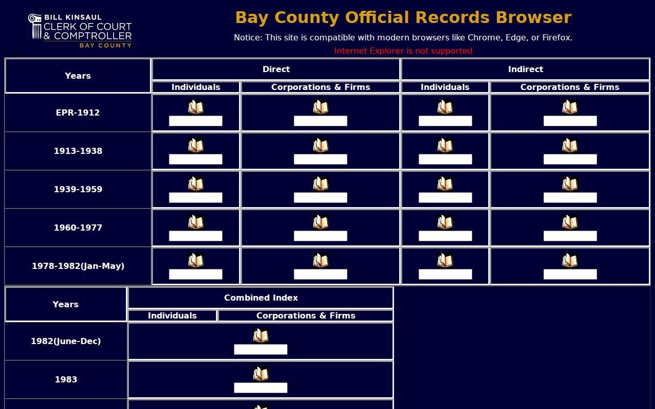
Read the alphabetic sheet, capture the referenced deed book and page, and then inspect the instrument. The Clerk's Direct/Indirect terms are office-specific, so verify the party's role on the image and search both sides when uncertain.
Map Earlier Panama City Residents
The 1917 Sanborn map has four sheets, while the 1927 edition has eighteen. These fire-insurance maps can date a structure's footprint, use, materials, block number, street label, and water or fire context. They do not name each occupant. Use them to explain a physical change, then return to directories, deeds, or census schedules for people.
The growth from four to eighteen sheets is a useful local measure of mapped development. When an address string fails, consult the sheet index and compare the legal parcel, nearby streets, and block number. No verified citywide renumbering year was found, so do not invent one.
Note: A map can show a building changed without proving that a Panama City household changed on the same date.
Bridge Panama City Resident Geography
St. Andrews, Millville, and Panama City were separate municipalities before their 1926 consolidation. An address may therefore appear under a different place heading without any household move. Search all three names in pre-consolidation maps, directories, newspapers, and indexes. The legal description is the stable bridge.
Bay County itself began in 1913. A courthouse fire in 1920 damaged the dome and clocks, and the outer walls survived. The official history does not say that a record group was lost, so a gap should never be blamed on the fire without direct archival evidence.
Match Panama City Owners to Occupants
Deeds identify title parties, not every resident. Bay County Public Library states that its local city-directory collection runs from 1935 to the present, but that collection-level statement does not prove every annual edition survives. Digitized 1938 and 1943 volumes and selected Polk reverse editions from 1953 through 1985 offer verified entry points. The collection details belong on the Panama City city directory page.
Use a simple flow: deed owner and dates → nearest directory years → reverse address entry → public census year → newspaper or probate evidence. Compare editions on both sides of a date because a listing can lag a move. The 1950 census is the newest public federal schedule under the 72-year rule, so later households need other sources.
When a person disappears, search the Bay Clerk probate docket, the Panama City Pilot run from 1907 to 1941, and Bay County Genealogical Society obituary or cemetery indexes. An index is a lead. Obtain the underlying notice, case file, or record image before treating it as proof.
Lawful use. Research Panama City previous residents for house history, genealogy, and lawful personal inquiry. Never use address records to harass, threaten, or track a living person.
Close Panama City Resident Gaps
The Bay County Public Library Local History Room offers noncirculating directories, more than 200 maps, newspapers, photos, yearbooks, and vertical files. Call 850-522-2132 or email genealogy@nwrls.com with the address, approximate period, older place name, and nearest known person. Ask for the closest directory edition and whether it includes a street-guide or reverse section.
Florida Memory's Bay officials series can add an officeholder's name, title, post-office address, appointment date, and disposition remark. The successful capture below links to that government-made historical index.
If online records fail, the Clerk's Official Records Room accepts counter, phone, email, and written copy requests. Earlier materials may also require library, State Archives, or FamilySearch catalog work. State the parcel, legal description, name variants, date range, and desired record type so staff can search a defined question.